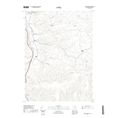
2019 Map of Jackson Summit
USGS Topo · Published 2019About this map
Tioga River valleys and the surrounding highlands of the Pennsylvania-New York border define this landscape, where steep hollows like Buckwheat Hollow and Barber Hollow cut through the terrain. The northern edge of the Tioga Reservoir dominates the southwest, while the Appalachian Throughway facilitates modern transit through this rural corridor. Historically significant family burial grounds, including Dickenson Cem, Middaugh Cem, and Tower Hill Cem, are scattered across the high ridges, providing critical touchpoints for genealogical research. Small crossroads communities such as Jackson Summit and Tioga Junction maintain their identities amidst the complex drainage network of Mitchell Creek and Alder Run. The varied elevation, peaking at Tower Hill and Buck Hill, illustrates the transition from river bottomlands to the upland plateaus that characterize the Tioga County borderlands.
Find a feature on this map
74 named features on this map. Tap any name to fly to it.
Don’t see what you’re looking for? This feature index may not catch every label — zoom into the map to look around manually.
Map Details
Editions of this 2019 Jackson Summit Map
This is the sole edition of this map. No revisions or reprints were ever made.
Other maps of this area

1895 · Elmira
USGS Topo · 1:62,500

1900 · Tioga
USGS Topo · 1:62,500

1902 · Tioga
USGS Topo · 1:62,500

1905 · Watkins Glen
USGS Topo · 1:125,000

1914 · Corning
USGS Topo · 1:62,500

1931 · Troy
USGS Topo · 1:48,000

1938 · Troy
USGS Topo · 1:62,500

1944 · Corning
USGS Topo · 1:62,500

1950 · Elmira
USGS Topo · 1:250,000

1953 · Roseville
USGS Topo · 1:24,000
Featured Places
- Lindley, NY
- Jackson Township, PA
- Tioga Township, PA
- Lawrence Township, PA
- Tioga Junction, Lawrence Township