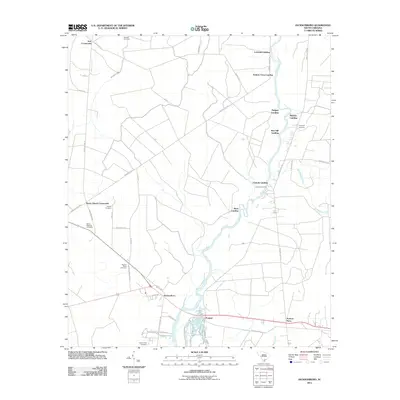
2011 Map of Jacksonboro
USGS Topo · Published 2011About this map
Jacksonboro and the neighboring settlement of Ponpon anchor this Lowcountry landscape along the winding course of the Edisto River. The river's historical importance as a commercial and transportation artery is evident through numerous established points such as Lowndes Landing, Parkers Ferry Landing, and Canady Landing. The interior is defined by a network of rural roads connecting significant intersections like Burnt Church Crossroads and Iron Crossroads, reflecting a long-standing pattern of agricultural and community distribution.
Find a feature on this map
47 named features on this map. Tap any name to fly to it.
Don’t see what you’re looking for? This feature index may not catch every label — zoom into the map to look around manually.
Map Details
Editions of this 2011 Jacksonboro Map
This is the sole edition of this map. No revisions or reprints were ever made.
Other maps of this area

1918 · Walterboro
USGS Topo · 1:62,500

1918 · Green Pond
USGS Topo · 1:62,500

1918 · Cottageville
USGS Topo · 1:62,500

1919 · Edisto Island
USGS Topo · 1:62,500

1943 · Cottageville
USGS Topo · 1:62,500

1943 · Edisto Island
USGS Topo · 1:62,500

1943 · Green Pond
USGS Topo · 1:62,500

1943 · Walterboro
USGS Topo · 1:62,500

1947 · Savannah
USGS Topo · 1:250,000

1948 · Savannah
USGS Topo · 1:250,000