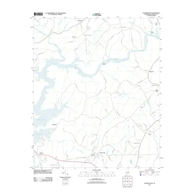
2011 Map of Jacksons Gap
USGS Topo · Published 2011About this map
The Tallapoosa River defines the landscape of this area, flowing through Irwin Shoals before widening into the northeastern reaches of Martin Lake. This 2011 survey captures the interface between the river's original channel and the reservoir's flooded timberlands. Near the southwestern corner, the community of Sturdivant sits where the topography begins to yield to the lake's fingers, including the winding Gin House Branch.
Find a feature on this map
85 named features on this map. Tap any name to fly to it.
Don’t see what you’re looking for? This feature index may not catch every label — zoom into the map to look around manually.
Map Details
Editions of this 2011 Jacksons Gap Map
This is the sole edition of this map. No revisions or reprints were ever made.
Other maps of this area

1891 · Ashland
USGS Topo · 1:125,000

1906 · Dadeville
USGS Topo · 1:125,000

1953 · Atlanta
USGS Topo · 1:250,000

1955 · Phenix City
USGS Topo · 1:250,000

1957 · Phenix City
USGS Topo · 1:250,000

1957 · Atlanta
USGS Topo · 1:250,000

1958 · Phenix City
USGS Topo · 1:250,000

1958 · Atlanta
USGS Topo · 1:250,000

1969 · New Site
USGS Topo · 1:24,000
1969 · Hackneyville
USGS Topo · 1:24,000