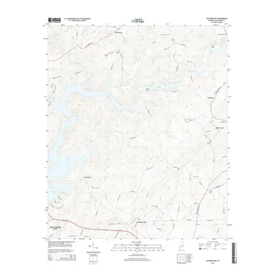
2014 Map of Jacksons Gap
USGS Topo · Published 2014About this map
Martin Lake and the Tallapoosa River dominate this Central Alabama landscape, where the waters are punctuated by features like Irwin Shoals and Peters Island. The map documents the rural character of Tallapoosa County, centered on the settlement of Jacksons Gap and the northern outskirts of Alexander City. Away from the main waterways, a network of country roads connects historic communities and family-named landmarks.
Find a feature on this map
90 named features on this map. Tap any name to fly to it.
Don’t see what you’re looking for? This feature index may not catch every label — zoom into the map to look around manually.
Map Details
Editions of this 2014 Jacksons Gap Map
This is the sole edition of this map. No revisions or reprints were ever made.
Other maps of this area

1891 · Ashland
USGS Topo · 1:125,000

1906 · Dadeville
USGS Topo · 1:125,000

1953 · Atlanta
USGS Topo · 1:250,000

1955 · Phenix City
USGS Topo · 1:250,000

1957 · Phenix City
USGS Topo · 1:250,000

1957 · Atlanta
USGS Topo · 1:250,000

1958 · Phenix City
USGS Topo · 1:250,000

1958 · Atlanta
USGS Topo · 1:250,000

1969 · New Site
USGS Topo · 1:24,000
1969 · Hackneyville
USGS Topo · 1:24,000