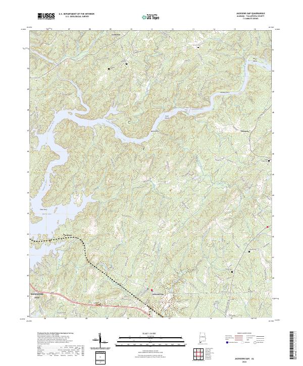
2024 Map of Jacksons Gap
USGS Topo · Published 2024About this map
Martin Lake and the Tallapoosa River dominate this portion of Tallapoosa County, where the water's winding reach separates settlements like Jacksons Gap and Sturdivant. The landscape is a complex network of narrow inlets and creeks, including Jay Bird Creek and Manoy Creek, which define the local topography. This modern survey illustrates the persistent rural character of the region, anchored by established communities and several small family or church burial grounds such as Concord Cem and Ephesus Cem.
Find a feature on this map
103 named features on this map. Tap any name to fly to it.
Don’t see what you’re looking for? This feature index may not catch every label — zoom into the map to look around manually.
Map Details
Editions of this 2024 Jacksons Gap Map
This is the sole edition of this map. No revisions or reprints were ever made.
Other maps of this area

1891 · Ashland
USGS Topo · 1:125,000

1906 · Dadeville
USGS Topo · 1:125,000

1953 · Atlanta
USGS Topo · 1:250,000

1955 · Phenix City
USGS Topo · 1:250,000

1957 · Phenix City
USGS Topo · 1:250,000

1957 · Atlanta
USGS Topo · 1:250,000

1958 · Phenix City
USGS Topo · 1:250,000

1958 · Atlanta
USGS Topo · 1:250,000

1969 · New Site
USGS Topo · 1:24,000
1969 · Hackneyville
USGS Topo · 1:24,000