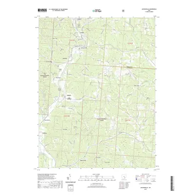
2019 Map of Jacksonville
USGS Topo · Published 2019About this map
Glouster and Trimble anchor the northern reaches of this landscape, where the headwaters of Sunday Cr carve through the hills of Athens County. This area is defined by a dense concentration of lineage-rich sites, including the Queen of Heaven Cemeteries and the Kidwell Covered Bridge, reflecting a long-established settlement pattern along the narrow valleys. The terrain rises sharply toward Taylor Ridge and Oregon Ridge, much of which is protected within the Wayne National Forest. To the south, the village of Millfield and the mining-legacy town of Chauncey sit near the confluence of the Hocking River, illustrating the transition from upland ridges to the broader river bottomlands. Numerous family cemeteries, such as Lefever Cem and Cary Cem, are scattered across the high ground, marking the sites of former homesteads that once lined roads like TWP HWY 345 and Salt Creek RD.
Find a feature on this map
115 named features on this map. Tap any name to fly to it.
Don’t see what you’re looking for? This feature index may not catch every label — zoom into the map to look around manually.
Map Details
Editions of this 2019 Jacksonville Map
This is the sole edition of this map. No revisions or reprints were ever made.
Other maps of this area

1903 · Athens
USGS Topo · 1:62,500

1904 · Chesterhill
USGS Topo · 1:62,500

1905 · Athens
USGS Topo · 1:62,500

1906 · Chesterhill
USGS Topo · 1:62,500

1910 · Mc Connelsville
USGS Topo · 1:62,500

1911 · New Lexington
USGS Topo · 1:62,500

1947 · Columbus
USGS Topo · 1:250,000

1949 · Clarksburg
USGS Topo · 1:250,000

1956 · Clarksburg
USGS Topo · 1:250,000

1960 · Amesville
USGS Topo · 1:24,000