
1957 Map of Jacksonville
USGS Topo · Published 1967About this map
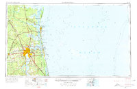
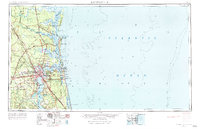
Jacksonville stands as a massive urban hub at the confluence of the St Johns River and the Atlantic, anchoring a landscape defined by deep-water military installations and sprawling coastal wetlands. The map reveals a high concentration of defense infrastructure, including the NAS Jacksonville naval station and the Kings Bay Ammunition Terminal just north of the border. Along the intricate shoreline, barrier islands like Cumberland Island and Amelia Island shield the mainland, while inland, the Seaboard Air Line and Southern Railway networks connect timber-rich areas like Cary State Forest to the port. Small riverside settlements such as Kings Ferry and Coleraine highlight the historical reliance on the St Marys River for transport and commerce during this mid-century period of rapid Florida expansion.
Find a feature on this map
88 named features on this map. Tap any name to fly to it.
Don’t see what you’re looking for? This feature index may not catch every label — zoom into the map to look around manually.
Map Details
Editions of this 1957 Jacksonville Map
3 editions found
Other maps of this area

1917 · Orange Park
USGS Topo · 1:62,500

1917 · Nahunta
USGS Topo · 1:62,500

1917 · Cambon
USGS Topo · 1:62,500

1917 · Boulogne
USGS Topo · 1:62,500

1917 · Macclenny
USGS Topo · 1:62,500

1917 · Hilliard
USGS Topo · 1:62,500

1918 · St Marys
USGS Topo · 1:62,500

1918 · Cumberland Island
USGS Topo · 1:62,500

1918 · Folkston
USGS Topo · 1:62,500

1918 · Middleburg
USGS Topo · 1:62,500