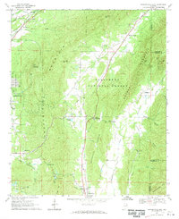
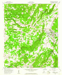
1967 Map of Jacksonville East
USGS Topo · Published 1970About this map
Dugger Mountain and the steep ridges of the Talladega National Forest dominate the eastern landscape of this 1967 survey. The terrain is deeply carved by watercourses like Tallasseehatchee Creek and Choccolocco Creek, which influenced the placement of early settlements and agricultural clearings. In the northwest, the intersection of the Southern Railway and the Seaboard Coast Line at Merrelton highlights the region's historical reliance on rail for transporting timber and minerals.
Find a feature on this map
47 named features on this map. Tap any name to fly to it.
Don’t see what you’re looking for? This feature index may not catch every label — zoom into the map to look around manually.
Map Details
Editions of this 1967 Jacksonville East Map
4 editions found
Other maps of this area

1900 · Anniston
USGS Topo · 1:125,000

1947 · Anniston
USGS Topo · 1:24,000

1947 · Colvin Gap
USGS Topo · 1:24,000

1947 · Jacksonville
USGS Topo · 1:24,000

1947 · Jacksonville
USGS Topo · 1:62,500

1950 · Anniston
USGS Topo · 1:62,500

1953 · Atlanta
USGS Topo · 1:250,000

1954 · Choccolocco
USGS Topo · 1:24,000

1956 · Anniston
USGS Topo · 1:24,000
1956 · Jacksonville
USGS Topo · 1:24,000