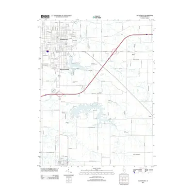
2012 Map of Jacksonville
USGS Topo · Published 2012About this map
Jacksonville serves as a significant educational and civic hub in Central Illinois, anchored by the campuses of Illinois College and MacMurray College. The landscape is defined by the winding course of Mauvaise Terre Creek and its various branches, which feed into Mauvaise Terre Lake and Lake Jacksonville. To the south, the village of Woodson sits near the headwaters of Spoon Creek, while the smaller settlements of Arnold, Pisgah, and South Jacksonville dot the surrounding prairie. This area is notably dense with family and community burial grounds, including East Cemetery, Memorial Lawn Cemetery, and the Holmes Daniel D Cemetery. These sites, along with landmarks like the Smith Landing Strip and Jacksonville Golf Course, provide a detailed record of land ownership and social infrastructure in Morgan County.
Find a feature on this map
147 named features on this map. Tap any name to fly to it.
Don’t see what you’re looking for? This feature index may not catch every label — zoom into the map to look around manually.
Map Details
Editions of this 2012 Jacksonville Map
This is the sole edition of this map. No revisions or reprints were ever made.
Other maps of this area

1924 · Winchester
USGS Topo · 1:48,000

1926 · Winchester
USGS Topo · 1:62,500

1929 · Arenzville
USGS Topo · 1:62,500

1932 · Arenzville
USGS Topo · 1:62,500

1932 · Jacksonville
USGS Topo · 1:62,500

1932 · Virginia
USGS Topo · 1:62,500

1936 · Virginia
USGS Topo · 1:62,500

1937 · Jacksonville
USGS Topo · 1:62,500

1948 · Quincy
USGS Topo · 1:250,000

1956 · Quincy
USGS Topo · 1:250,000