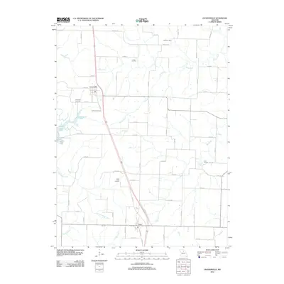
2012 Map of Jacksonville
USGS Topo · Published 2012About this map
Jacksonville and Cairo serve as the primary residential anchors in this part of Randolph County, Missouri, connected by a network of rural routes and the central corridor of Elgin St. The landscape is defined by its agricultural character and the dendritic drainage of Hoover Creek, Mud Creek, and the East Fork Walnut Creek. This 2012 survey illustrates the distribution of historic burial grounds that continue to mark the local geography, including Jacksonville Cemetery, Colter Cemetery, and Grand Prairie Cemetery. Water management for local use is evident at Pastrovich Lake Dam and the recreational developments surrounding Holiday Acres Lake. Farther east, the Snow Post Office remains a notable landmark of the region's postal and community history. The map detail reflects a transition from traditional land use toward modern subdivisions and private lake developments, while maintaining the traditional grid of county roads that have organized this territory for generations.
Find a feature on this map
67 named features on this map. Tap any name to fly to it.
Don’t see what you’re looking for? This feature index may not catch every label — zoom into the map to look around manually.
Map Details
Editions of this 2012 Jacksonville Map
This is the sole edition of this map. No revisions or reprints were ever made.
Other maps of this area

1890 · Moberly
USGS Topo · 1:125,000

1890 · Glasgow
USGS Topo · 1:125,000

1908 · Macon
USGS Topo · 1:62,500

1910 · Macon
USGS Topo · 1:62,500

1952 · Middle Grove
USGS Topo · 1:24,000

1953 · Moberly
USGS Topo · 1:250,000

1953 · Huntsville
USGS Topo · 1:24,000

1953 · Bevier South
USGS Topo · 1:24,000

1953 · College Mound
USGS Topo · 1:24,000
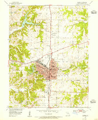
1953 · Moberly
USGS Topo · 1:24,000