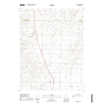
2017 Map of Jacksonville
USGS Topo · Published 2017About this map
Jacksonville and Cairo anchor this central Missouri landscape at the border of Macon and Randolph counties. The terrain is defined by a dense network of local roads and watercourses, including Mud Cr and the E Fork Walnut Cr. Of particular interest to genealogists and local historians are several burial grounds scattered throughout the quadrangle, notably the Missouri Veterans Cem Jacksonville and the older Colter Cem, Jacksonville Cem, and Union Cem.
Find a feature on this map
93 named features on this map. Tap any name to fly to it.
Don’t see what you’re looking for? This feature index may not catch every label — zoom into the map to look around manually.
Map Details
Editions of this 2017 Jacksonville Map
This is the sole edition of this map. No revisions or reprints were ever made.
Other maps of this area

1890 · Moberly
USGS Topo · 1:125,000

1890 · Glasgow
USGS Topo · 1:125,000

1908 · Macon
USGS Topo · 1:62,500

1910 · Macon
USGS Topo · 1:62,500

1952 · Middle Grove
USGS Topo · 1:24,000

1953 · Moberly
USGS Topo · 1:250,000

1953 · Huntsville
USGS Topo · 1:24,000

1953 · Bevier South
USGS Topo · 1:24,000

1953 · College Mound
USGS Topo · 1:24,000
1953 · Moberly
USGS Topo · 1:24,000