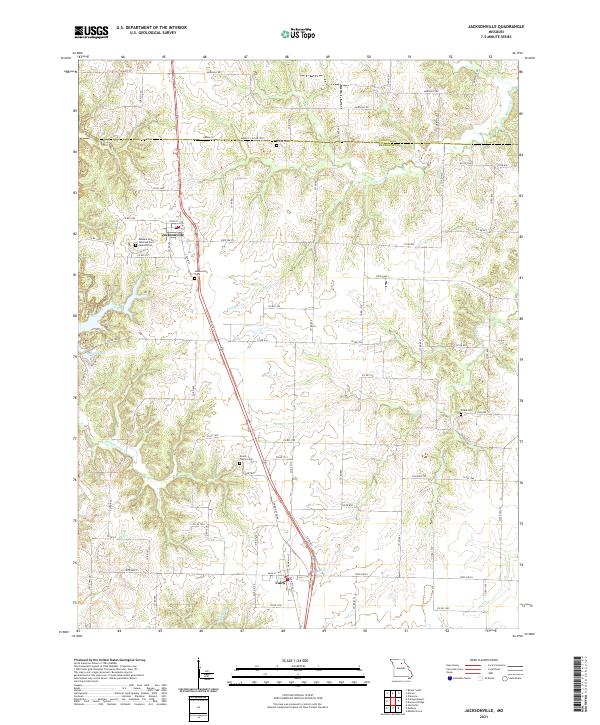
2021 Map of Jacksonville
USGS Topo · Published 2021About this map
The Missouri State Veterans Cem - Jacksonville serves as a prominent landmark on this north-central Missouri landscape, situated just west of the small community of Jacksonville. The terrain is defined by a dendritic drainage pattern where numerous creeks, including Hoover Cr and Mud Cr, carve through the rolling agricultural lands. To the south, the village of Cairo sits at a crossroads of regional transportation routes, including State Highway Z and Highway DD.
Find a feature on this map
87 named features on this map. Tap any name to fly to it.
Don’t see what you’re looking for? This feature index may not catch every label — zoom into the map to look around manually.
Map Details
Editions of this 2021 Jacksonville Map
This is the sole edition of this map. No revisions or reprints were ever made.
Other maps of this area

1890 · Moberly
USGS Topo · 1:125,000

1890 · Glasgow
USGS Topo · 1:125,000

1908 · Macon
USGS Topo · 1:62,500

1910 · Macon
USGS Topo · 1:62,500

1952 · Middle Grove
USGS Topo · 1:24,000

1953 · Moberly
USGS Topo · 1:250,000

1953 · Huntsville
USGS Topo · 1:24,000

1953 · Bevier South
USGS Topo · 1:24,000

1953 · College Mound
USGS Topo · 1:24,000
1953 · Moberly
USGS Topo · 1:24,000