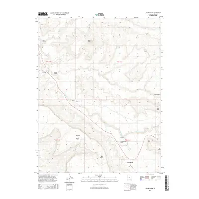
2014 Map of Jacobs Chair
USGS Topo · Published 2014About this map
Fry Canyon anchors this high-desert landscape in San Juan County, where the seasonal drainage of White Canyon Cr cuts through ancient sandstone layers. The terrain is defined by dramatic mesas and monoliths, including the towering Jacobs Chair and Wingate Mesa. Human activity is centered along Ut-95, which follows the contours of the canyon floor, connecting historic transit points like Soldier Crossing and Gravel Crossing. The presence of the Fry Canyon Field Airport and the winding Radium King Rd suggests the area's ongoing significance for regional aviation and access to the backcountry. To the east, landmarks such as Found Mesa and Fry Point overlook deep canyons, while Rock Spring provides a rare water source in an otherwise arid environment characterized by sheer drops and sprawling mesas like Moss Back and Fry Mesa.
Find a feature on this map
25 named features on this map. Tap any name to fly to it.
Don’t see what you’re looking for? This feature index may not catch every label — zoom into the map to look around manually.
Map Details
Editions of this 2014 Jacobs Chair Map
This is the sole edition of this map. No revisions or reprints were ever made.
Other maps of this area

1886 · Henry Mountains
USGS Topo · 1:250,000

1892 · Henry Mountains
USGS Topo · 1:250,000

1952 · Mouth of Dark Canyon
USGS Topo · 1:62,500

1952 · Mancos Mesa
USGS Topo · 1:62,500

1952 · Natural Bridges
USGS Topo · 1:62,500

1952 · Hite
USGS Topo · 1:62,500

1954 · White Canyon 3 SE
USGS Topo · 1:24,000

1954 · White Canyon 4 NE
USGS Topo · 1:24,000

1954 · White Canyon 4 SE
USGS Topo · 1:24,000
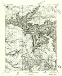
1954 · White Canyon 1 SE
USGS Topo · 1:24,000