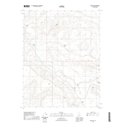
2020 Map of Jacobs Chair
USGS Topo · Published 2020About this map
Jacobs Chair stands as a prominent landmark in this desert landscape of San Juan County, part of a topography defined by steep-walled mesas and deep drainages. The area is centered on the winding course of White Canyon Cr, which has carved out notable features like Gravel Canyon and Cowboy Canyon. Human presence is marked by rural infrastructure such as Co RD 227a and the Fry Canyon Field, which sits near the head of Fry Canyon.
Find a feature on this map
16 named features on this map. Tap any name to fly to it.
Don’t see what you’re looking for? This feature index may not catch every label — zoom into the map to look around manually.
Map Details
Editions of this 2020 Jacobs Chair Map
This is the sole edition of this map. No revisions or reprints were ever made.
Other maps of this area

1886 · Henry Mountains
USGS Topo · 1:250,000

1892 · Henry Mountains
USGS Topo · 1:250,000

1952 · Mouth of Dark Canyon
USGS Topo · 1:62,500

1952 · Mancos Mesa
USGS Topo · 1:62,500

1952 · Natural Bridges
USGS Topo · 1:62,500

1952 · Hite
USGS Topo · 1:62,500

1954 · White Canyon 3 SE
USGS Topo · 1:24,000

1954 · White Canyon 4 NE
USGS Topo · 1:24,000

1954 · White Canyon 4 SE
USGS Topo · 1:24,000
1954 · White Canyon 1 SE
USGS Topo · 1:24,000