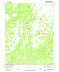
1969 Map of Jacobs Reservoir
USGS Topo · Published 1973About this map
High-elevation terrain of the Aquarius Plateau dominates this late-1960s survey, characterized by a dense concentration of alpine lakes and basins within the Dixie National Forest. At the heart of the region, Jacobs Reservoir sits at over ten thousand feet, feeding into Pine Creek as it descends the plateau's southern slopes. The landscape is a network of geologic shelves and volcanic features, including the Black Stairs and the broad expanse of Boulder Mountain.
Find a feature on this map
45 named features on this map. Tap any name to fly to it.
Don’t see what you’re looking for? This feature index may not catch every label — zoom into the map to look around manually.
Map Details
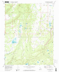
Editions of this 1969 Jacobs Reservoir Map
2 editions found
Other maps of this area

1885 · Fish Lake
USGS Topo · 1:250,000

1886 · Escalante
USGS Topo · 1:250,000

1896 · Fish Lake
USGS Topo · 1:250,000

1952 · Notom 3 SW
USGS Topo · 1:24,000

1952 · Notom 3 NW
USGS Topo · 1:24,000

1952 · Grover
USGS Topo · 1:62,500

1953 · Loa 4 NE
USGS Topo · 1:24,000

1956 · Escalante
USGS Topo · 1:250,000

1956 · Salina
USGS Topo · 1:250,000

1960 · Escalante
USGS Topo · 1:250,000