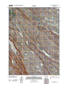
2011 Map of Jacobs Reservoir
USGS Topo · Published 2011About this map
Guano Creek winds through the high desert landscape of Lake County, Oregon, defining a terrain dominated by ephemeral water sources and expansive flats. This area of the Great Basin is characterized by its network of shallow lakes, reservoirs, and waterholes that speak to the region's ranching and land management history. Central features like Jacobs Reservoir and O'Keefe Reservoir sit alongside family-named or utilitarian landmarks such as Wire Corral Flat and Squib Waterhole. The map illustrates a system of drainage and storage, where Warner Creek and various catchments like Handle Reservoir and June Reservoir provide critical water in an otherwise arid environment. From the elevation of Cat Butte to the broad expanse of Big Flat, the topography is shaped by internal drainage basins typical of this part of the Pacific Northwest.
Find a feature on this map
23 named features on this map. Tap any name to fly to it.
Don’t see what you’re looking for? This feature index may not catch every label — zoom into the map to look around manually.
Map Details
Editions of this 2011 Jacobs Reservoir Map
This is the sole edition of this map. No revisions or reprints were ever made.
Other maps of this area

1955 · Adel
USGS Topo · 1:250,000

1957 · Adel
USGS Topo · 1:250,000

1958 · Adel
USGS Topo · 1:250,000

1962 · Adel
USGS Topo · 1:250,000

1967 · Jacobs Reservoir
USGS Topo · 1:24,000

1967 · Alger Lake
USGS Topo · 1:24,000

1967 · Hart Lake
USGS Topo · 1:24,000

1967 · Warner Peak
USGS Topo · 1:24,000

1967 · Swede Knoll
USGS Topo · 1:24,000

1967 · Crump Lake
USGS Topo · 1:24,000