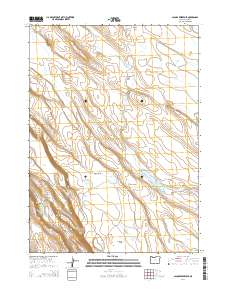
2014 Map of Jacobs Reservoir
USGS Topo · Published 2014About this map
Guano Cr and its northern branch, Guano Crk, carve through this high desert terrain in Lake County, Oregon. The landscape is defined by its seasonal water sources and intermittent basins, such as Jacobs Reservoir and the uniquely named Fortyfour Lake. This 2014 survey documents a network of named flats and depressions, including Spanish Flat and Wire Corral Flat, which suggest a history of range management and livestock grazing.
Find a feature on this map
33 named features on this map. Tap any name to fly to it.
Don’t see what you’re looking for? This feature index may not catch every label — zoom into the map to look around manually.
Map Details
Editions of this 2014 Jacobs Reservoir Map
This is the sole edition of this map. No revisions or reprints were ever made.
Other maps of this area

1955 · Adel
USGS Topo · 1:250,000

1957 · Adel
USGS Topo · 1:250,000

1958 · Adel
USGS Topo · 1:250,000

1962 · Adel
USGS Topo · 1:250,000

1967 · Jacobs Reservoir
USGS Topo · 1:24,000

1967 · Alger Lake
USGS Topo · 1:24,000

1967 · Hart Lake
USGS Topo · 1:24,000

1967 · Warner Peak
USGS Topo · 1:24,000

1967 · Swede Knoll
USGS Topo · 1:24,000

1967 · Crump Lake
USGS Topo · 1:24,000