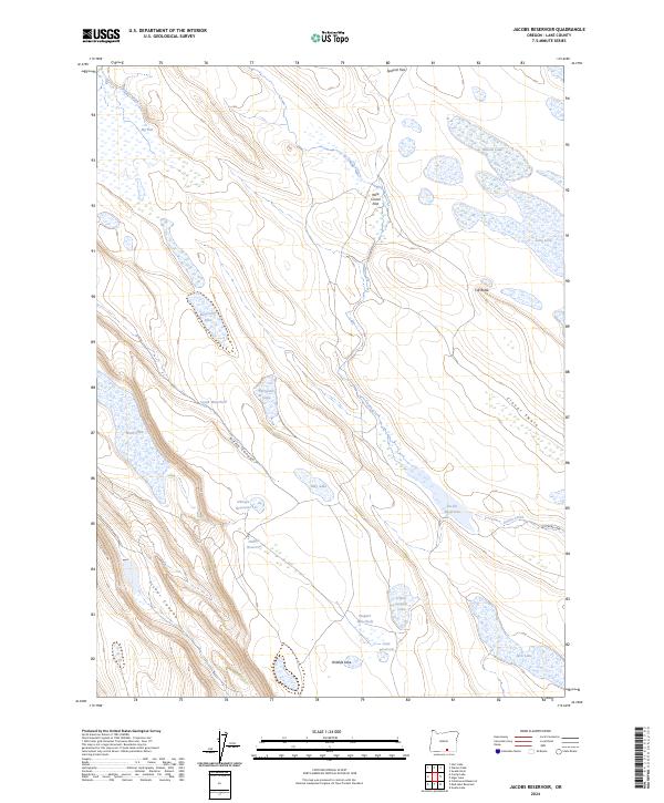
2024 Map of Jacobs Reservoir
USGS Topo · Published 2024About this map
The Hart Mountain National Antelope Refuge dominates this high-desert terrain in Lake County, Oregon, where a sophisticated network of catchments and seasonal basins defines the land's utility. Water management for wildlife and livestock is evident through features like Jacobs Reservoir, O'Keefe Reservoir, and Handle Reservoir. The landscape is a mix of broad volcanic flats such as Big Flat and Wire Corral Flat, punctuated by steep relief in Riffle Canyon and Fisher Canyon. This modern survey illustrates the persistent importance of named water sources in the arid basin, from the isolated Wagner Waterhole to the strangely named School Section Lake. Along the eastern edge, drainage follows Guano Creek and Clover Swale, while landmarks like Cat Butte provide orientation points across the expansive sagebrush steppe.
Find a feature on this map
30 named features on this map. Tap any name to fly to it.
Don’t see what you’re looking for? This feature index may not catch every label — zoom into the map to look around manually.
Map Details
Editions of this 2024 Jacobs Reservoir Map
This is the sole edition of this map. No revisions or reprints were ever made.
Other maps of this area

1955 · Adel
USGS Topo · 1:250,000

1957 · Adel
USGS Topo · 1:250,000

1958 · Adel
USGS Topo · 1:250,000

1962 · Adel
USGS Topo · 1:250,000

1967 · Jacobs Reservoir
USGS Topo · 1:24,000

1967 · Alger Lake
USGS Topo · 1:24,000

1967 · Hart Lake
USGS Topo · 1:24,000

1967 · Warner Peak
USGS Topo · 1:24,000

1967 · Swede Knoll
USGS Topo · 1:24,000

1967 · Crump Lake
USGS Topo · 1:24,000