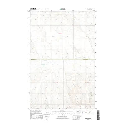
2017 Map of Jakes Coulee
USGS Topo · Published 2017About this map
The W Fork Poplar River carves through this northern Montana landscape, marking the transition between Daniels and Roosevelt counties. This 2017 study illustrates a sparse, high-plains environment defined by natural drainages and the rigid lines of the Public Land Survey System. Modern infrastructure is limited to corridors like Lannon Rd, which cuts across the township boundaries of t33n r47e. The map captures the subtle topography of the Wolf Point District, where water is the primary sculptor of the terrain. Narrow draws like Police Cr and Cottonwood Cr feed into the larger river system, while the namesake Jakes Coulee provides a distinct landmark for local navigability and historical land use in this open ranching country.
Find a feature on this map
9 named features on this map. Tap any name to fly to it.
Don’t see what you’re looking for? This feature index may not catch every label — zoom into the map to look around manually.
Map Details
Editions of this 2017 Jakes Coulee Map
This is the sole edition of this map. No revisions or reprints were ever made.
Other maps of this area

1910 · Cuskers
USGS Topo · 1:62,500

1915 · Tule Valley
USGS Topo · 1:62,500

1915 · Cuskers
USGS Topo · 1:62,500

1954 · Wolf Point
USGS Topo · 1:250,000

1958 · Wolf Point
USGS Topo · 1:250,000

1973 · Peerless 4 NE
USGS Topo · 1:24,000

1973 · Nielsen Coulee
USGS Topo · 1:24,000

1973 · Cabarett Coulee
USGS Topo · 1:24,000

1973 · Peerless 4 SE
USGS Topo · 1:24,000

1973 · Peerless 4 SW
USGS Topo · 1:24,000