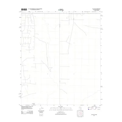
2012 Map of Jal SE
USGS Topo · Published 2012About this map
Monument Draw cuts a subtle north-south path through this arid portion of Lea County, serving as the primary natural drainage feature in a landscape defined by its grid-based infrastructure. The 2012 survey illustrates the intersection of rural Texas and New Mexico transport networks, where Ranch Road 1218 transitions into FM 1218 at the state line. This area is characterized by long-distance rural roads and sparse development, with local access provided by routes like SW 9751. The map records the precise layout of property boundaries and service roads that supported the region's land use in the early 21st century, offering a clear view of the desert terrain before more recent industrial shifts.
Find a feature on this map
4 named features on this map. Tap any name to fly to it.
Don’t see what you’re looking for? This feature index may not catch every label — zoom into the map to look around manually.
Map Details
Editions of this 2012 Jal SE Map
This is the sole edition of this map. No revisions or reprints were ever made.
Other maps of this area

1954 · Hobbs
USGS Topo · 1:250,000

1954 · Pecos
USGS Topo · 1:250,000

1957 · Pecos
USGS Topo · 1:250,000

1958 · Hobbs
USGS Topo · 1:250,000

1969 · Jal NE
USGS Topo · 1:24,000

1969 · Jal NW
USGS Topo · 1:24,000

1969 · Jal
USGS Topo · 1:24,000

1969 · Jal SE
USGS Topo · 1:24,000

1970 · Vesrue
USGS Topo · 1:24,000

1970 · Kermit NW
USGS Topo · 1:24,000