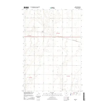
2015 Map of James
USGS Topo · Published 2015About this map
James sits at the heart of this rural landscape in Brown County, where the sprawling path of the James River winds through the western sections of the quadrangle. This 2015 survey reveals a classic prairie section-line grid, defined by a network of local connectors like 399th Ave and 131st St. The small settlement is anchored by the James Cem and connected via the aptly named James Rd. In the southeastern corner, the meandering course of Mud Cr cuts through the township boundaries of T122n R61w, highlighting the subtle drainage patterns that dictate the placement of farmsteads and agricultural plots. The map provides a detailed view of the modern infrastructure of South Dakota's Glacial Lake Plain, showing how the land remains partitioned by the historic Public Land Survey System even as modern highway 12 bisects the territory.
Find a feature on this map
23 named features on this map. Tap any name to fly to it.
Don’t see what you’re looking for? This feature index may not catch every label — zoom into the map to look around manually.
Map Details
Editions of this 2015 James Map
This is the sole edition of this map. No revisions or reprints were ever made.
Other maps of this area

1894 · Columbia
USGS Topo · 1:62,500

1895 · Aberdeen
USGS Topo · 1:125,000

1896 · Columbia
USGS Topo · 1:125,000

1952 · Huffton
USGS Topo · 1:24,000

1952 · Columbia
USGS Topo · 1:24,000

1952 · Putney
USGS Topo · 1:24,000

1953 · Stratford
USGS Topo · 1:24,000

1953 · Groton SW
USGS Topo · 1:24,000

1954 · Bath
USGS Topo · 1:24,000

1954 · Groton
USGS Topo · 1:24,000