
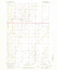
1954 Map of James
USGS Topo · Published 1955About this map
The James R meanders through the heart of Brown County, South Dakota, defining the landscape of townships like Henry and West Hanson during the mid-1950s. This survey, conducted as part of the Missouri River Basin development program, captures a rural agrarian network organized around the Chicago Milwaukee St Paul and Pacific railroad line. The tiny settlement of James serves as a central point, anchored by the nearby James Cemetery. The map is particularly notable for its dense distribution of rural educational sites, including the Wilson Sch and Joan of Arc Sch, alongside facilities already noted as out of use, such as the Lincoln Sch and Nightingale Sch. This density of named schoolhouses reflects the peak of the district-school system before widespread consolidation transformed these prairie communities.
Find a feature on this map
17 named features on this map. Tap any name to fly to it.
Don’t see what you’re looking for? This feature index may not catch every label — zoom into the map to look around manually.
Map Details
Editions of this 1954 James Map
2 editions found
Other maps of this area

1894 · Columbia
USGS Topo · 1:62,500

1895 · Aberdeen
USGS Topo · 1:125,000

1896 · Columbia
USGS Topo · 1:125,000

1952 · Huffton
USGS Topo · 1:24,000

1952 · Columbia
USGS Topo · 1:24,000

1952 · Putney
USGS Topo · 1:24,000

1953 · Stratford
USGS Topo · 1:24,000

1953 · Groton SW
USGS Topo · 1:24,000

1954 · Bath
USGS Topo · 1:24,000

1954 · Groton
USGS Topo · 1:24,000