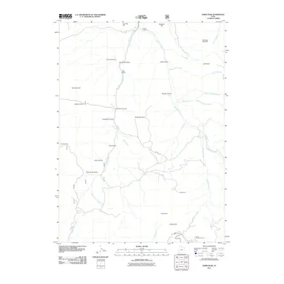
2011 Map of James Peak
USGS Topo · Published 2011About this map
James Peak and Cobabe Peak define the high terrain of this landscape in the northern Wasatch Range. The drainage network is complex, with the South Fork Little Bear River drawing water from numerous side-canyons like Threemile Canyon and Fourmile Canyon. Cultural evidence on the land includes the Bluebell Mine and the Honey Bee Mine, alongside legacy place names such as Mormon Hollow and Shingle Mill Hollow that point to the early industry and settlement of the region. At the southern edge, the Powder Mountain Ski Area marks the modern recreational use of these peaks. Farther north, the Fourmile Ranch sits near McKenzie Flat, illustrating the high-elevation ranching character that persists alongside these mountain watersheds.
Find a feature on this map
37 named features on this map. Tap any name to fly to it.
Don’t see what you’re looking for? This feature index may not catch every label — zoom into the map to look around manually.
Map Details
Editions of this 2011 James Peak Map
This is the sole edition of this map. No revisions or reprints were ever made.
Other maps of this area

1914 · Logan
USGS Topo · 1:125,000

1916 · Logan
USGS Topo · 1:125,000

1954 · Ogden
USGS Topo · 1:250,000

1955 · Paradise
USGS Topo · 1:24,000

1955 · Mantua
USGS Topo · 1:24,000

1955 · Huntsville
USGS Topo · 1:24,000

1955 · James Peak
USGS Topo · 1:24,000

1955 · North Ogden
USGS Topo · 1:24,000

1955 · Mount Pisgah
USGS Topo · 1:24,000

1958 · Ogden
USGS Topo · 1:250,000
Featured Places
- Powder Mountain, UT
- Sundown Condominiums at Powder Mountain, UT
- Weber County, UT
- Cache County, UT
- Box Elder County, UT