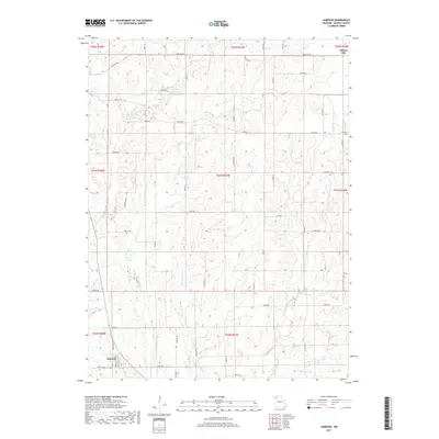
2017 Map of Jameson
USGS Topo · Published 2017About this map
The small rural community of Jameson anchors the southwestern corner of this Northwest Missouri landscape, where local life follows the natural divisions created by several significant waterways. The terrain is defined by the drainage systems of Big Muddy Cr and Little Muddy Cr, which flow through a network of sections and ranges typical of the American Midwest. These creeks, alongside Hickory Cr and Pilot Grove Cr, influenced the placement of original farmsteads and rural roads like State Rd B and State Rd P. Toward the northeast, the outskirts of Gilman City appear, while the Hill Cem provides a specific point of interest for genealogists tracing early families in Daviess County. The southern reach of the map features Cook Lake and the winding path of Lost Cr, illustrating a landscape managed for both agriculture and water resources in the modern era.
Find a feature on this map
31 named features on this map. Tap any name to fly to it.
Don’t see what you’re looking for? This feature index may not catch every label — zoom into the map to look around manually.
Map Details
Editions of this 2017 Jameson Map
This is the sole edition of this map. No revisions or reprints were ever made.
Other maps of this area

1922 · Gallatin
USGS Topo · 1:62,500

1924 · Winston
USGS Topo · 1:62,500

1925 · Pattonsburg
USGS Topo · 1:62,500

1925 · Gilman
USGS Topo · 1:62,500

1944 · Pattonsburg
USGS Topo · 1:62,500

1946 · Gilman
USGS Topo · 1:48,000

1946 · Pattonsburg
USGS Topo · 1:48,000

1948 · Gilman
USGS Topo · 1:62,500

1948 · Pattonsburg
USGS Topo · 1:62,500

1950 · Kansas City
USGS Topo · 1:250,000