
1965 Map of Jameson Lake East
USGS Topo · Published 1966About this map
Moses Coulee dominates this mid-1960s topographic survey of the Douglas County landscape, where the deeply carved basaltic valley floor contains a string of notable water bodies including Jameson Lake and Grimes Lake. The terrain is defined by dramatic elevation changes, moving from the lake surfaces up through the steep walls of Long Canyon and Sulphur Canyon toward higher plateau features like Chester Butte. Human activity in this arid environment is represented by a network of jeep trails, scattered storage bins, and a small Gravel Pit in the southeast. Water management and access are central themes here, evidenced by labels for Twin Lakes, Fisher Lakes, and a Dry Well, reflecting the challenges of agricultural and industrial life in the Coulee country during the mid-twentieth century.
Find a feature on this map
15 named features on this map. Tap any name to fly to it.
Don’t see what you’re looking for? This feature index may not catch every label — zoom into the map to look around manually.
Map Details
Editions of this 1965 Jameson Lake East Map
This is the sole edition of this map. No revisions or reprints were ever made.
Other maps of this area

1953 · Ritzville
USGS Topo · 1:250,000

1959 · Ritzville
USGS Topo · 1:250,000

1965 · Ritzville
USGS Topo · 1:250,000

1965 · Jameson Lake SW
USGS Topo · 1:24,000

1965 · Jameson Lake SE
USGS Topo · 1:24,000

1965 · St. Andrews
USGS Topo · 1:24,000

1965 · Jameson Lake West
USGS Topo · 1:24,000
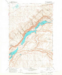
1965 · Park Lake
USGS Topo · 1:24,000
1968 · Barnes Butte
USGS Topo · 1:24,000
1968 · Mansfield
USGS Topo · 1:24,000