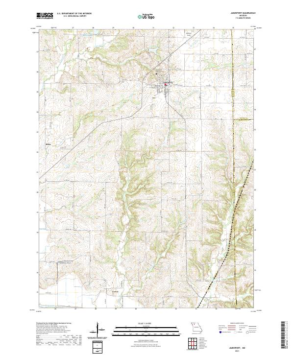
2021 Map of Jamesport
USGS Topo · Published 2021About this map
Jamesport sits at the heart of this Daviess County landscape, a well-defined agricultural and transit hub where State Rd F and State Hwy F converge. The town's grid is anchored by Spillman Field and the Jamesport Memorial Cem to the north, while the Landmark Manufacturing Corporation Airport serves as a modern industrial waypoint to the southwest. The terrain is defined by a dense network of waterways including Muddy Cr, Thompson Cr, and Hurricane Br, which all drain toward the Grand River at the southern boundary.
Find a feature on this map
45 named features on this map. Tap any name to fly to it.
Don’t see what you’re looking for? This feature index may not catch every label — zoom into the map to look around manually.
Map Details
Editions of this 2021 Jamesport Map
This is the sole edition of this map. No revisions or reprints were ever made.
Other maps of this area

1921 · Chillicothe
USGS Topo · 1:62,500

1922 · Gallatin
USGS Topo · 1:62,500

1923 · Chillicothe
USGS Topo · 1:62,500

1925 · Gilman
USGS Topo · 1:62,500

1946 · Gilman
USGS Topo · 1:48,000

1948 · Gilman
USGS Topo · 1:62,500

1948 · Trenton
USGS Topo · 1:62,500

1953 · Moberly
USGS Topo · 1:250,000

1954 · Centerville
USGS Topo · 1:250,000

1954 · Moberly
USGS Topo · 1:250,000