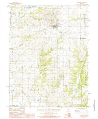
1984 Map of Jamesport
USGS Topo · Published 1985About this map
Jamesport serves as the primary hub of this north-central Missouri landscape, situated near the headwaters of several drainages that feed into the Grand River to the west. The area is defined by its agrarian patterns and water resources, including Jamesport Community Lake and City Lake. A notable industrial artifact is the Old Railroad Grade cutting across the northern half of the map, signifying the changing transportation priorities of the mid-20th century.
Find a feature on this map
28 named features on this map. Tap any name to fly to it.
Don’t see what you’re looking for? This feature index may not catch every label — zoom into the map to look around manually.
Map Details
Editions of this 1984 Jamesport Map
This is the sole edition of this map. No revisions or reprints were ever made.
Other maps of this area

1921 · Chillicothe
USGS Topo · 1:62,500

1922 · Gallatin
USGS Topo · 1:62,500

1923 · Chillicothe
USGS Topo · 1:62,500

1925 · Gilman
USGS Topo · 1:62,500

1946 · Gilman
USGS Topo · 1:48,000

1948 · Gilman
USGS Topo · 1:62,500

1948 · Trenton
USGS Topo · 1:62,500

1953 · Moberly
USGS Topo · 1:250,000

1954 · Centerville
USGS Topo · 1:250,000

1954 · Moberly
USGS Topo · 1:250,000