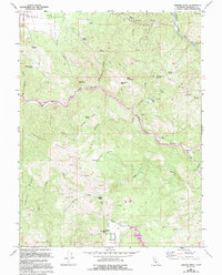
1967 Map of Jamison Ridge
USGS Topo · Published 1994About this map
The Middle Fork Eel River carves a deep path through the center of this terrain, serving as the primary geographical axis for the surrounding ridges and canyons. To the north, the southern edge of Round Valley is visible, featuring the Pioneer Cem near the intersection of Hill Rd. This area reflects a landscape of cattle ranching and early mountain life, anchored by sites like the Eden Valley Ranch and the historical Marks Place (Site) near Salmon Creek.
Find a feature on this map
36 named features on this map. Tap any name to fly to it.
Don’t see what you’re looking for? This feature index may not catch every label — zoom into the map to look around manually.
Map Details
Editions of this 1967 Jamison Ridge Map
3 editions found
Other maps of this area

1920 · Covelo
USGS Topo · 1:62,500

1926 · Covelo
USGS Topo · 1:62,500

1929 · Eden Valley
USGS Topo · 1:62,500

1951 · Laytonville
USGS Topo · 1:62,500

1952 · Spyrock
USGS Topo · 1:62,500

1952 · Eden Valley
USGS Topo · 1:62,500

1952 · Covelo
USGS Topo · 1:62,500

1957 · Ukiah
USGS Topo · 1:250,000

1960 · Ukiah
USGS Topo · 1:250,000
1966 · Sanhedrin Mtn
USGS Topo · 1:24,000