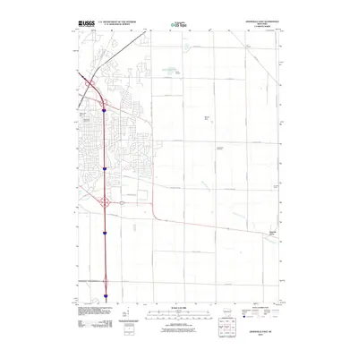
2010 Map of Janesville East
USGS Topo · Published 2010About this map
Emerald Grove and the residential expansion of eastern Janesville define the character of this Rock County landscape in the early 21st century. The map illustrates a transition from the dense residential street grids near Milton Lawn Memorial Park and Blackhawk Golf Course to the sprawling agricultural tracts of the eastern townships. Rural landmarks like Six Corners and Venable Farms anchor the outlying areas, while the terrain is marked by the prominence of Mount Zion. Local water systems including Spring Brook and Blackhawk Creek meander through the territory, passing sites like Camp Rotamer and Spauldings Pond. For those tracing local heritage, the inclusion of Mount Zion Cemetery along the north-south corridor of N Milton Shopeire Rd provides a specific point of reference for historical research in the region.
Find a feature on this map
41 named features on this map. Tap any name to fly to it.
Don’t see what you’re looking for? This feature index may not catch every label — zoom into the map to look around manually.
Map Details
Editions of this 2010 Janesville East Map
This is the sole edition of this map. No revisions or reprints were ever made.
Other maps of this area

1890 · Stoughton
USGS Topo · 1:62,500

1891 · Koshkonong
USGS Topo · 1:62,500

1891 · Janesville
USGS Topo · 1:62,500

1893 · Janesville
USGS Topo · 1:62,500

1893 · Shopiere
USGS Topo · 1:62,500

1894 · Koshkonong
USGS Topo · 1:62,500

1906 · Koshkonong
USGS Topo · 1:62,500

1954 · Rockford
USGS Topo · 1:250,000

1955 · Rockford
USGS Topo · 1:250,000

1958 · Rockford
USGS Topo · 1:250,000