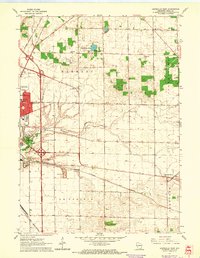
1961 Map of Janesville East
USGS Topo · Published 1964About this map
The eastern edges of Janesville meet the rolling agricultural lands of Rock County in the early 1960s, a landscape defined by the intersection of industrial transport and rural education. The Chicago Milwaukee St Paul and Pacific and the Chicago and North Western railroads anchor the local economy, cutting across the townships of Harmony and La Prairie. This period shows a robust network of country schools, including Harmony Sch, Blackhawk Sch, and Howarth Sch, which served the farming families before district consolidation became widespread.
Find a feature on this map
31 named features on this map. Tap any name to fly to it.
Don’t see what you’re looking for? This feature index may not catch every label — zoom into the map to look around manually.
Map Details
Editions of this 1961 Janesville East Map
3 editions found
Other maps of this area

1890 · Stoughton
USGS Topo · 1:62,500

1891 · Koshkonong
USGS Topo · 1:62,500

1891 · Janesville
USGS Topo · 1:62,500

1893 · Janesville
USGS Topo · 1:62,500

1893 · Shopiere
USGS Topo · 1:62,500

1894 · Koshkonong
USGS Topo · 1:62,500

1906 · Koshkonong
USGS Topo · 1:62,500

1954 · Rockford
USGS Topo · 1:250,000

1955 · Rockford
USGS Topo · 1:250,000

1958 · Rockford
USGS Topo · 1:250,000