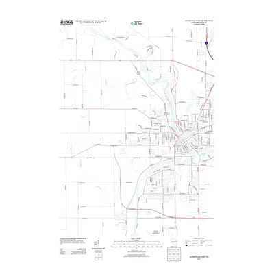
2013 Map of Janesville West
USGS Topo · Published 2013About this map
The Rock River winds through this region of southern Wisconsin, serving as the primary geographic corridor for the western reaches of Janesville. The landscape is defined by the convergence of several waterways, including Marsh Creek, Fisher Creek, and Markham Creek, which flow toward the river through a mix of established residential neighborhoods and open valley land. A significant modern landmark is the Ice Age National Scenic Trail, which meanders across the terrain, following the glacial topography that shaped this part of Rock County. Urban development is concentrated along major transit arteries like Milton Ave and Kennedy Rd, while local recreational spots such as Kiwanis Pond and the corridor of Spring Brook provide community focal points. The map illustrates the transition from the dense street grids of the city center to the more linear residential patterns emerging along the riverbanks.
Find a feature on this map
171 named features on this map. Tap any name to fly to it.
Don’t see what you’re looking for? This feature index may not catch every label — zoom into the map to look around manually.
Map Details
Editions of this 2013 Janesville West Map
This is the sole edition of this map. No revisions or reprints were ever made.
Other maps of this area

1890 · Stoughton
USGS Topo · 1:62,500

1891 · Koshkonong
USGS Topo · 1:62,500

1891 · Janesville
USGS Topo · 1:62,500

1893 · Janesville
USGS Topo · 1:62,500

1893 · Shopiere
USGS Topo · 1:62,500

1894 · Koshkonong
USGS Topo · 1:62,500

1906 · Koshkonong
USGS Topo · 1:62,500

1954 · Rockford
USGS Topo · 1:250,000

1955 · Rockford
USGS Topo · 1:250,000

1958 · Rockford
USGS Topo · 1:250,000