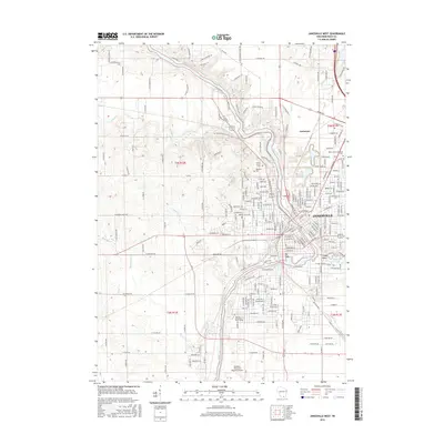
2016 Map of Janesville West
USGS Topo · Published 2016About this map
The Rock River carves a winding path through this western portion of Janesville, dictating the layout of residential streets and industrial infrastructure. In the early 21st century, the city's westward expansion is visible through established neighborhoods and the campus of the University of Wisconsin Rock County. Significant local history is preserved in the large grounds of Mount Olivet Cemetery and Oak Hill Cemetery, which sit alongside the river's bend. To the south, the Southern Wisconsin Regional Airport serves as a major transportation hub, while natural landmarks like Big Rock and the elevations of Arbor Ridge provide geographic contrast to the urban grid. Recreational spaces including Lions Beach and Kiwanis Pond highlight the community's focus on the riverfront, while the presence of Marsh Creek and Fisher Creek underscores the complex drainage patterns of the Rock County landscape.
Find a feature on this map
230 named features on this map. Tap any name to fly to it.
Don’t see what you’re looking for? This feature index may not catch every label — zoom into the map to look around manually.
Map Details
Editions of this 2016 Janesville West Map
This is the sole edition of this map. No revisions or reprints were ever made.
Other maps of this area

1890 · Stoughton
USGS Topo · 1:62,500

1891 · Koshkonong
USGS Topo · 1:62,500

1891 · Janesville
USGS Topo · 1:62,500

1893 · Janesville
USGS Topo · 1:62,500

1893 · Shopiere
USGS Topo · 1:62,500

1894 · Koshkonong
USGS Topo · 1:62,500

1906 · Koshkonong
USGS Topo · 1:62,500

1954 · Rockford
USGS Topo · 1:250,000

1955 · Rockford
USGS Topo · 1:250,000

1958 · Rockford
USGS Topo · 1:250,000