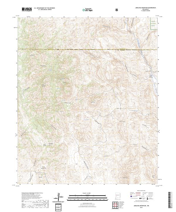
2023 Map of Jaralosa Mountain
USGS Topo · Published 2023About this map
Sierra Cuchillo and the high desert peaks of the Cibola National Forest define this landscape along the border of Socorro and Sierra counties. The terrain is a complex network of drainage systems, where Alamosa Creek flows through Monticello Canyon in the northeast, and dry washes like Lemes Canyon and Walnut Canyon carve through the foothills. Small water sources were critical for local ranching and transit, evidenced by named sites such as Witch Spring, Romero Spring, and Rock Tank.
Find a feature on this map
45 named features on this map. Tap any name to fly to it.
Don’t see what you’re looking for? This feature index may not catch every label — zoom into the map to look around manually.
Map Details
Editions of this 2023 Jaralosa Mountain Map
This is the sole edition of this map. No revisions or reprints were ever made.
Other maps of this area

1954 · Tularosa
USGS Topo · 1:250,000

1958 · Tularosa
USGS Topo · 1:250,000

1961 · Priest Tank
USGS Topo · 1:24,000

1961 · Monticello
USGS Topo · 1:24,000

1964 · Vicks Peak
USGS Topo · 1:24,000

1964 · Montoya Butte
USGS Topo · 1:24,000

1965 · Winston
USGS Topo · 1:24,000

1965 · Iron Mountain
USGS Topo · 1:24,000

1965 · Jaralosa Mountain
USGS Topo · 1:24,000
1965 · Chise
USGS Topo · 1:24,000