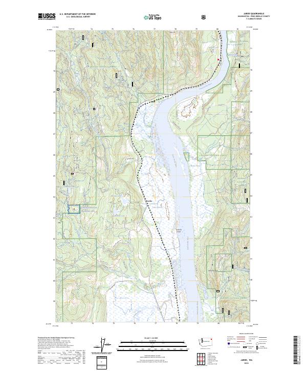
2023 Map of Jared
USGS Topo · Published 2023About this map
The Pend Oreille River carves a wide path through this northeastern Washington landscape, anchoring a region defined by its timberlands and water resources. The small settlements of Jared and Locke sit along the western banks, connected by a network of rural routes like Co Hwy 2441 and Locke Cutoff Rd. A significant portion of the area is managed by the Kaniksu National Forest, which surrounds numerous alpine and valley water bodies including Babbitz Lake, Parker Lake, and the cluster of Metcalf Lake, Lake Lucerne, and Brownie Lake. To the west, the Cusick Survival Training Site occupies the higher elevations near Ruby Mtn, while prominent landmarks like Sullivan Point and Gibraltar Rock provide clear navigational markers for the rugged interior terrain.
Find a feature on this map
47 named features on this map. Tap any name to fly to it.
Don’t see what you’re looking for? This feature index may not catch every label — zoom into the map to look around manually.
Map Details
Editions of this 2023 Jared Map
This is the sole edition of this map. No revisions or reprints were ever made.
Other maps of this area

1934 · Metaline
USGS Topo · 1:125,000

1936 · Newport
USGS Topo · 1:96,000

1942 · Metaline
USGS Topo · 1:125,000

1942 · Newport
USGS Topo · 1:125,000

1958 · Sandpoint
USGS Topo · 1:250,000

1963 · Sandpoint
USGS Topo · 1:250,000

1967 · Timber Mtn.
USGS Topo · 1:24,000
1967 · North Baldy
USGS Topo · 1:24,000
1967 · Ruby
USGS Topo · 1:24,000

1968 · Cusick
USGS Topo · 1:24,000