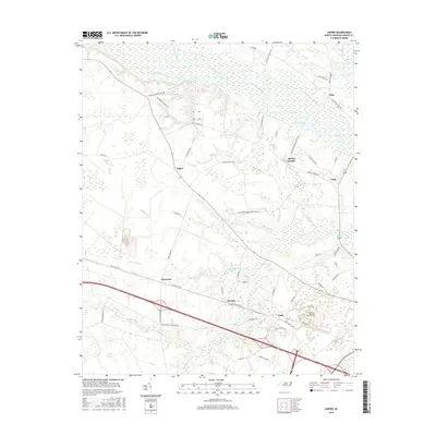
2016 Map of Jasper
USGS Topo · Published 2016About this map
The Neuse River winds through the northern reaches of this Craven County landscape, where the flat coastal plains meet significant wetlands like the Great Dover Swamp. This 2016 survey illustrates a patchwork of small communities and family-named homesteads, often situated along the corridors of the Old US Hwy 70 W. Settlements such as Jasper, Tuscarora, and Hymans anchor the local geography, connected by a network of rural roads that cross numerous tributaries like Turkey Quarter Creek and Bachelor Creek. The presence of features such as NW Craven Middle School Rd and SW Craven Middle School Rd indicates the central role of educational infrastructure in this modern rural setting. The terrain is defined by its intricate hydrography, with smaller streams like Beaverdam Br and Mill Run draining the low-lying timber and agricultural lands that have long defined this portion of eastern North Carolina.
Find a feature on this map
63 named features on this map. Tap any name to fly to it.
Don’t see what you’re looking for? This feature index may not catch every label — zoom into the map to look around manually.
Map Details
Editions of this 2016 Jasper Map
This is the sole edition of this map. No revisions or reprints were ever made.
Other maps of this area

1901 · New Bern
USGS Topo · 1:62,500

1902 · Ayden
USGS Topo · 1:62,500

1902 · Vanceboro
USGS Topo · 1:62,500

1903 · New Bern
USGS Topo · 1:62,500

1903 · Trent River
USGS Topo · 1:62,500

1904 · Ayden
USGS Topo · 1:62,500

1904 · Trent River
USGS Topo · 1:62,500

1904 · Vanceboro
USGS Topo · 1:62,500

1905 · Vanceboro
USGS Topo · 1:62,500

1950 · Pollocksville
USGS Topo · 1:24,000