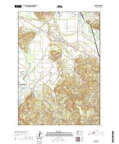
2020 Map of Jasper
USGS Topo · Published 2020About this map
Pleasant Hill and the surrounding Lane County countryside are defined by the convergence of the Middle Fork Willamette River and Coast Fork Willamette River. This rural landscape is heavily marked by its local history, with numerous burial grounds such as Pleasant Hill Cem, Mulholland Cem, and Sellers Cem located near the town centers. The map shows a transition from the river bottomlands to prominent elevations like Sellers Butte and Rattlesnake Butte. To the west, the edge of Creswell appears near the junction of Camas Swale Cr, while the community of Cloverdale serves as a central hub for the network of rural roads and timber land. Modern water management is represented by the Robberson Reservoir, situated among the drainage of Pudding Cr and Papenfus Cr.
Find a feature on this map
83 named features on this map. Tap any name to fly to it.
Don’t see what you’re looking for? This feature index may not catch every label — zoom into the map to look around manually.
Map Details
Editions of this 2020 Jasper Map
This is the sole edition of this map. No revisions or reprints were ever made.
Other maps of this area

1910 · Eugene
USGS Topo · 1:62,500

1921 · Cottage Grove
USGS Topo · 1:62,500

1935 · Lowell
USGS Topo · 1:96,000

1940 · Eugene
USGS Topo · 1:62,500

1942 · Lowell
USGS Topo · 1:125,000

1946 · Eugene
USGS Topo · 1:62,500

1949 · Eugene
USGS Topo · 1:62,500

1950 · Marcola
USGS Topo · 1:62,500

1952 · Marcola
USGS Topo · 1:62,500

1953 · Salem
USGS Topo · 1:250,000