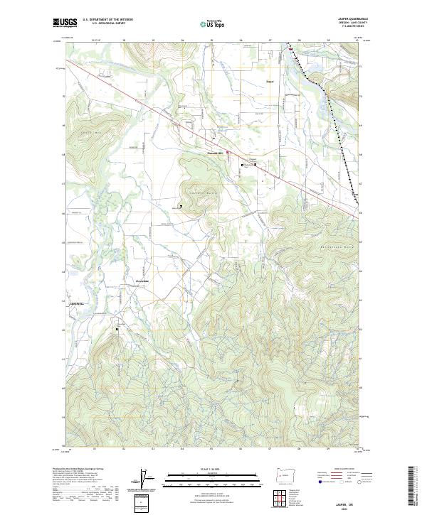
2023 Map of Jasper
USGS Topo · Published 2023About this map
The Coast Fork Willamette River and Middle Fork Willamette River converge in this section of Lane County, defining a landscape of river bottoms and rising buttes. The settlement of Pleasant Hill occupies the central valley, flanked by historic burial grounds including Pleasant Hill Cem and Mulholland Cem. Further south, the community of Cloverdale sits near the Cloverdale Cem, while the eastern edge of Creswell appears along the western map margin.
Find a feature on this map
85 named features on this map. Tap any name to fly to it.
Don’t see what you’re looking for? This feature index may not catch every label — zoom into the map to look around manually.
Map Details
Editions of this 2023 Jasper Map
This is the sole edition of this map. No revisions or reprints were ever made.
Other maps of this area

1910 · Eugene
USGS Topo · 1:62,500

1921 · Cottage Grove
USGS Topo · 1:62,500

1935 · Lowell
USGS Topo · 1:96,000

1940 · Eugene
USGS Topo · 1:62,500

1942 · Lowell
USGS Topo · 1:125,000

1946 · Eugene
USGS Topo · 1:62,500

1949 · Eugene
USGS Topo · 1:62,500

1950 · Marcola
USGS Topo · 1:62,500

1952 · Marcola
USGS Topo · 1:62,500

1953 · Salem
USGS Topo · 1:250,000