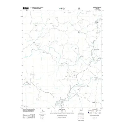
2011 Map of Jasper
USGS Topo · Published 2011About this map
The Buffalo River and Little Buffalo River define the topography of this Newton County landscape, converging near the settlement of Jasper. This 2011 survey documents a region defined by its narrow hollows and high bluffs, where traditional family names persist across the land in sites like Tom Thumb Cemetery and Adair Cemetery. The community of Dogpatch sits in the northeast, near the Spring Bluff and the geological curiosity of Marble Falls, while the southern reaches show the winding path of Carlton Branch and Spider Creek.
Find a feature on this map
79 named features on this map. Tap any name to fly to it.
Don’t see what you’re looking for? This feature index may not catch every label — zoom into the map to look around manually.
Map Details
Editions of this 2011 Jasper Map
This is the sole edition of this map. No revisions or reprints were ever made.
Other maps of this area

1904 · Harrison
USGS Topo · 1:125,000

1905 · Harrison
USGS Topo · 1:125,000

1933 · Mt Judea
USGS Topo · 1:62,500

1940 · Mt Judea
USGS Topo · 1:62,500

1945 · Harrison
USGS Topo · 1:250,000

1949 · Harrison
USGS Topo · 1:250,000

1954 · Harrison
USGS Topo · 1:250,000

1956 · Russellville
USGS Topo · 1:250,000

1958 · Harrison
USGS Topo · 1:250,000

1964 · Russellville
USGS Topo · 1:250,000