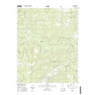
2017 Map of Jasper
USGS Topo · Published 2017About this map
The Little Buffalo River winds northward to meet the Buffalo River in this detailed study of central Newton County. The terrain is defined by dramatic elevation changes between high points like Sherman Mtn and deep valleys such as Wildcat Hollow and Sawmill Hollow. Small settlements and family landmarks are scattered throughout the landscape, including Pruitt and Erbie, along with numerous historic burial sites such as Pruitt Cem, Shaddox Cem, and Adair Cem. This era of the Ozarks shows a balance between protected public lands, including the Ozark National Forest, and local rural infrastructure. The network of county roads, such as Co RD 80 and Erbie Rd, provides insight into the connectivity of these upland communities and their reliance on the river valleys for passage.
Find a feature on this map
98 named features on this map. Tap any name to fly to it.
Don’t see what you’re looking for? This feature index may not catch every label — zoom into the map to look around manually.
Map Details
Editions of this 2017 Jasper Map
This is the sole edition of this map. No revisions or reprints were ever made.
Other maps of this area

1904 · Harrison
USGS Topo · 1:125,000

1905 · Harrison
USGS Topo · 1:125,000

1933 · Mt Judea
USGS Topo · 1:62,500

1940 · Mt Judea
USGS Topo · 1:62,500

1945 · Harrison
USGS Topo · 1:250,000

1949 · Harrison
USGS Topo · 1:250,000

1954 · Harrison
USGS Topo · 1:250,000

1956 · Russellville
USGS Topo · 1:250,000

1958 · Harrison
USGS Topo · 1:250,000

1964 · Russellville
USGS Topo · 1:250,000