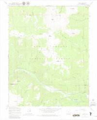
1967 Map of Jasper
USGS Topo · Published 1980About this map
High-altitude wilderness and early Forest Service infrastructure define this area of the Rio Grande National Forest during the late 1960s. The settlement of Jasper and the Alamosa River serve as the primary landmarks in a landscape dominated by peaks and water-carved gulches. Remote outposts like the Fitton Guard Station and Alamosa Guard Station highlight the administrative presence required for managing these timber and watershed lands. The map details a complex network of travel through the mountains, including a Stock Driveway and numerous Pack Trails, which suggests the enduring importance of seasonal grazing and backcountry access. Geological features such as Marble Mountain, Cornwalls Nose, and the San Francisco Lakes provide specific points of interest for those studying the physical geography or land-use history of the Rio Grande and Conejos county borderlands.
Find a feature on this map
44 named features on this map. Tap any name to fly to it.
Don’t see what you’re looking for? This feature index may not catch every label — zoom into the map to look around manually.
Map Details
Editions of this 1967 Jasper Map
3 editions found
Other maps of this area

1913 · Summitville
USGS Topo · 1:125,000

1914 · Creede
USGS Topo · 1:125,000

1915 · Summitville
USGS Topo · 1:125,000

1915 · Del Norte
USGS Topo · 1:125,000

1916 · Creede
USGS Topo · 1:125,000

1917 · Del Norte
USGS Topo · 1:125,000

1922 · Conejos
USGS Topo · 1:125,000

1945 · Durango
USGS Topo · 1:250,000

1953 · Durango
USGS Topo · 1:250,000

1954 · Durango
USGS Topo · 1:250,000