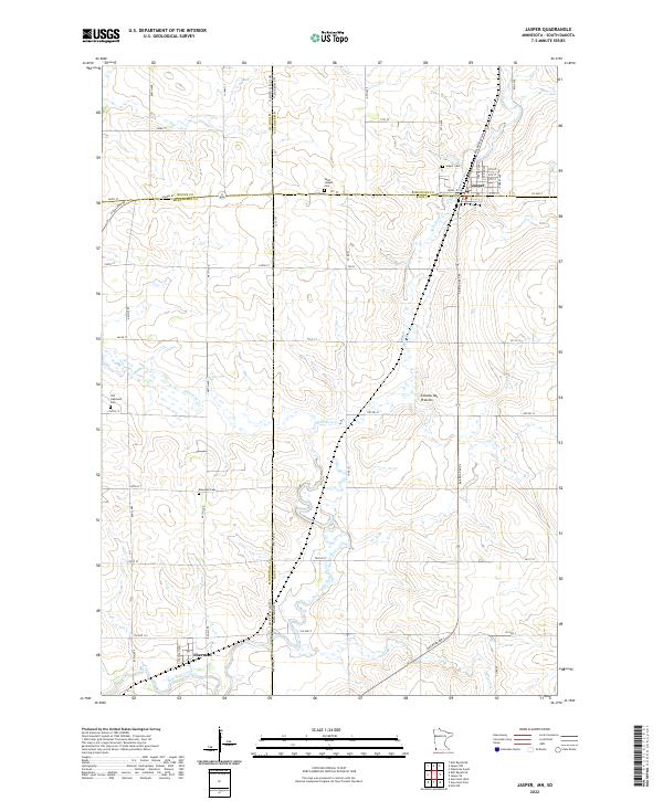
2022 Map of Jasper
USGS Topo · Published 2022About this map
Jasper sits at the intersection of Pipestone and Rock counties, where the high ground of the Coteau des Prairies slopes down toward the winding waters of Split Rock Creek. This borderland terrain is marked by a legacy of early prairie settlement, with significant genealogical resources including Jasper Cem, Saint Joseph Cem, and Rosendal Cem. The town itself is organized around the corridor of Railroad Ave N, while the southern settlement of Sherman anchors the map near the border with South Dakota.
Find a feature on this map
57 named features on this map. Tap any name to fly to it.
Don’t see what you’re looking for? This feature index may not catch every label — zoom into the map to look around manually.
Map Details
Editions of this 2022 Jasper Map
This is the sole edition of this map. No revisions or reprints were ever made.
Other maps of this area

1955 · Sioux Falls
USGS Topo · 1:250,000

1958 · Sioux Falls
USGS Topo · 1:250,000

1962 · Garretson West
USGS Topo · 1:24,000

1967 · Garretson East
USGS Topo · 1:24,000

1967 · Jasper SE
USGS Topo · 1:24,000

1967 · Hills NE
USGS Topo · 1:24,000

1967 · Pipestone South
USGS Topo · 1:24,000

1967 · Jasper
USGS Topo · 1:24,000

1967 · Jasper NW
USGS Topo · 1:24,000
1972 · Dell Rapids NE
USGS Topo · 1:24,000