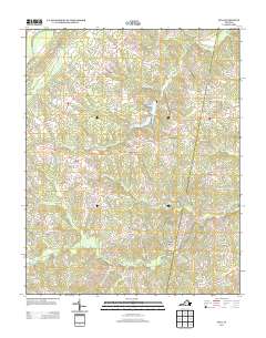
2013 Map of Java
USGS Topo · Published 2013About this map
Java and Peytonsburg serve as primary anchors for this rural landscape in Halifax County, where a network of secondary roads such as Va-729 and Halifax RD connect small, longstanding communities. The geography is defined by a dense system of waterways, including the Bannister River in the northwest and the winding paths of Sandy Cr and Elkhorn Cr that cross the terrain. The central reach of the quadrangle is dominated by Elkhorn Lake, a significant water body situated north of the Ebenezer and Lucks settlements.
Find a feature on this map
63 named features on this map. Tap any name to fly to it.
Don’t see what you’re looking for? This feature index may not catch every label — zoom into the map to look around manually.
Map Details
Editions of this 2013 Java Map
This is the sole edition of this map. No revisions or reprints were ever made.
Other maps of this area

1921 · Chatham
USGS Topo · 1:48,000

1923 · Danville
USGS Topo · 1:48,000

1923 · Chatham
USGS Topo · 1:62,500

1925 · Danville
USGS Topo · 1:62,500

1952 · Milton
USGS Topo · 1:62,500

1953 · Greensboro
USGS Topo · 1:250,000

1954 · Greensboro
USGS Topo · 1:250,000

1954 · Riceville
USGS Topo · 1:62,500

1956 · Milton
USGS Topo · 1:62,500

1962 · Greensboro
USGS Topo · 1:250,000