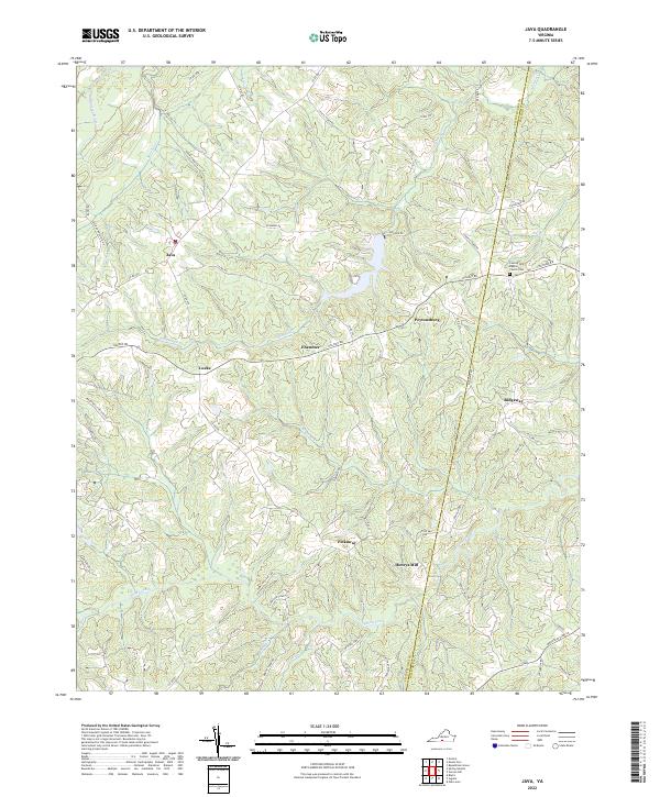
2022 Map of Java
USGS Topo · Published 2022About this map
Peytonsburg and the rural crossroads of Java define the landscape of eastern Pittsylvania County, situated just west of the border with Halifax County. The terrain is deeply incised by the drainage systems of Elkhorn Cr and Sandy Creek, which flow toward the Bannister River in the northwest. This network of waterways historically influenced the placement of early infrastructure, such as the site of Henry's Mill and the long-established County Line Baptist Church Cem near the county line. The map reveals a settlement pattern of small hamlets like Pickaway, Lucks, and Ebenezer, connected by a web of timber and farm roads. These routes, including Halifax Rd and Yeatts Store Rd, reflect the agricultural legacy of this tobacco-growing region in the Virginia Piedmont.
Find a feature on this map
62 named features on this map. Tap any name to fly to it.
Don’t see what you’re looking for? This feature index may not catch every label — zoom into the map to look around manually.
Map Details
Editions of this 2022 Java Map
This is the sole edition of this map. No revisions or reprints were ever made.
Other maps of this area

1921 · Chatham
USGS Topo · 1:48,000

1923 · Danville
USGS Topo · 1:48,000

1923 · Chatham
USGS Topo · 1:62,500

1925 · Danville
USGS Topo · 1:62,500

1952 · Milton
USGS Topo · 1:62,500

1953 · Greensboro
USGS Topo · 1:250,000

1954 · Greensboro
USGS Topo · 1:250,000

1954 · Riceville
USGS Topo · 1:62,500

1956 · Milton
USGS Topo · 1:62,500

1962 · Greensboro
USGS Topo · 1:250,000