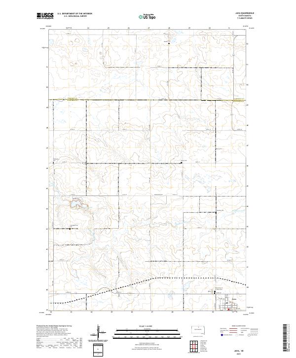
2021 Map of Java
USGS Topo · Published 2021About this map
Java anchors the southeastern corner of this landscape at the border of Walworth and Campbell counties, where the town grid is defined by Main St and Railway Ave. The surrounding prairie is characterized by a high density of rural burial grounds, including the Bender Cem, Salzsiedler Cem, Peace Cem, and Schnaible Cem, which speak to the area's early settlement history and community genealogy. Central to the map's geography is the Hiddenwood Cr drainage system, which feeds into Hiddenwood Lake. This water feature provides a natural focal point amidst the section-line road network, accompanied by the Hidden Beauty Trl and Hiddenwood Rd. The distribution of the Congregational Cem and the United Church of Christ Cem suggests a landscape historically rooted in distinct denominational congregations.
Find a feature on this map
40 named features on this map. Tap any name to fly to it.
Don’t see what you’re looking for? This feature index may not catch every label — zoom into the map to look around manually.
Map Details
Editions of this 2021 Java Map
This is the sole edition of this map. No revisions or reprints were ever made.
Other maps of this area

1953 · McIntosh
USGS Topo · 1:250,000

1954 · Aberdeen
USGS Topo · 1:250,000

1956 · Aberdeen
USGS Topo · 1:250,000

1958 · McIntosh
USGS Topo · 1:250,000

1967 · Mound City
USGS Topo · 1:24,000

1967 · Selby
USGS Topo · 1:24,000

1968 · Akaska NE
USGS Topo · 1:24,000

1974 · Spring Lake
USGS Topo · 1:24,000
1974 · Lowry NW
USGS Topo · 1:24,000

1978 · Salt Lake
USGS Topo · 1:24,000