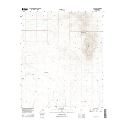
2014 Map of Javelina Peak
USGS Topo · Published 2014About this map
Javelina Peak dominates the eastern high ground of this Graham County landscape, marking a prominent point within the Whitlock Mountains. The terrain transitions sharply from these rocky heights into the broad, arid expanse of the San Simon Valley to the west. Water management is the primary evidence of human activity in this desert environment, with numerous catchment points such as K M P Tank, Lost Tank, and Seely Tank distributed across the township sections. The ephemeral San Simon River winds through the valley floor, joined by drainage features like Gold Gulch and Ryan Draw. Historical routes and local access are represented by Hackel Rd, which strikes across the basin near the curiously named Starvation Flat, providing a detailed look at the geographic nomenclature used by ranchers and early travelers in the Arizona borderlands.
Find a feature on this map
20 named features on this map. Tap any name to fly to it.
Don’t see what you’re looking for? This feature index may not catch every label — zoom into the map to look around manually.
Map Details
Editions of this 2014 Javelina Peak Map
This is the sole edition of this map. No revisions or reprints were ever made.
Other maps of this area

1917 · San Simon
USGS Topo · 1:125,000

1922 · Willcox
USGS Topo · 1:125,000

1928 · Bowie
USGS Topo · 1:62,500

1944 · Fisher Hills
USGS Topo · 1:62,500

1949 · Bowie
USGS Topo · 1:62,500

1950 · Bowie
USGS Topo · 1:62,500

1954 · Silver City
USGS Topo · 1:250,000

1957 · Luzena
USGS Topo · 1:62,500

1958 · Silver City
USGS Topo · 1:250,000

1962 · Silver City
USGS Topo · 1:250,000