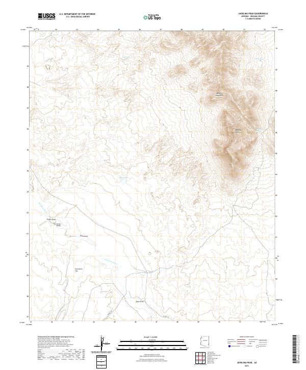
2021 Map of Javelina Peak
USGS Topo · Published 2021About this map
The Whitlock Mountains dominate the northeastern portion of this Graham County survey, anchored by the prominent Javelina Peak. This arid landscape is defined by the broad San Simon Valley to the south and west, where the San Simon River winds through open terrain. Water management is the primary sign of human adaptation in this desert environment, evidenced by scattered livestock watering points like Lost Tank, Seely Tank, and K M P Tank. The drainage patterns are clearly delineated through numerous named arroyos and washes, including Timber Draw, Ryan Draw, and Gold Gulch, while the oddly named Starvation Flat suggests the challenging nature of the local geography. Ranching infrastructure and remote desert access are further indicated by Hackel Rd and the vital Dripping Spring tucked into the mountain slopes.
Find a feature on this map
19 named features on this map. Tap any name to fly to it.
Don’t see what you’re looking for? This feature index may not catch every label — zoom into the map to look around manually.
Map Details
Editions of this 2021 Javelina Peak Map
This is the sole edition of this map. No revisions or reprints were ever made.
Other maps of this area

1917 · San Simon
USGS Topo · 1:125,000

1922 · Willcox
USGS Topo · 1:125,000

1928 · Bowie
USGS Topo · 1:62,500

1944 · Fisher Hills
USGS Topo · 1:62,500

1949 · Bowie
USGS Topo · 1:62,500

1950 · Bowie
USGS Topo · 1:62,500

1954 · Silver City
USGS Topo · 1:250,000

1957 · Luzena
USGS Topo · 1:62,500

1958 · Silver City
USGS Topo · 1:250,000

1962 · Silver City
USGS Topo · 1:250,000