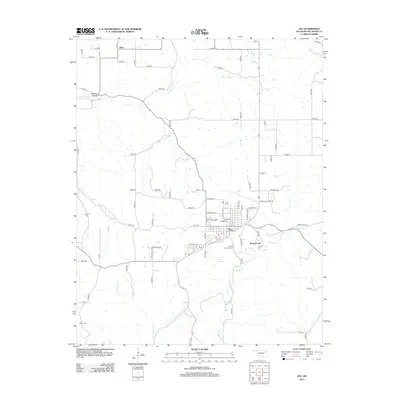
2012 Map of Jay
USGS Topo · Published 2012About this map
Jay serves as the central hub for this portion of Delaware County, shown here as a structured grid of residential streets and localized industry. The town sits at the intersection of several regional corridors, surrounded by a landscape defined by traditional land names like Ulm Prairie and Muskrat Hollow. Waterways such as Drowning Cr and Brush Creek wind through the terrain, dictating the placement of rural roads and historical properties. For local history researchers, the map identifies significant family and community landmarks, including the Duffield Memorial Cem and Jumper Cem located just southeast of the main settlement. Further north, the smaller community of Zena anchors the upper reaches of the quadrangle near Whitewater Cr, reflecting the established rural settlement patterns of northeastern Oklahoma in the early 21st century.
Find a feature on this map
74 named features on this map. Tap any name to fly to it.
Don’t see what you’re looking for? This feature index may not catch every label — zoom into the map to look around manually.
Map Details
Editions of this 2012 Jay Map
This is the sole edition of this map. No revisions or reprints were ever made.
Other maps of this area

1899 · Siloam Springs
USGS Topo · 1:125,000

1903 · Siloam Springs
USGS Topo · 1:125,000

1904 · Siloam Springs
USGS Topo · 1:125,000

1907 · Wyandotte
USGS Topo · 1:125,000

1909 · Wyandotte
USGS Topo · 1:125,000

1954 · Tulsa
USGS Topo · 1:250,000

1958 · Tulsa
USGS Topo · 1:250,000

1963 · Tulsa
USGS Topo · 1:250,000

1964 · Dodge
USGS Topo · 1:24,000

1971 · Kenwood
USGS Topo · 1:24,000