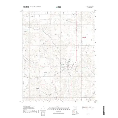
2018 Map of Jay
USGS Topo · Published 2018About this map
Jay serves as the central hub of this northeastern Oklahoma landscape, where the street grid of the county seat transitions into the complex drainage networks of the Ozark plateau. To the south, the settlement of New Eucha sits near the shores of Eucha Lake, a geography defined by the winding course of Rattlesnake Cr. The terrain is deeply dissected by a series of named valleys including Muskrat Hollow, Round Spring Hollow, and Woodward Hollow, while the more level expanse of Ulm Prairie offers a distinct contrast to the surrounding ridges. For those tracing family histories, several burial sites are documented across the township lines, including the Duffield Memorial Cem and Jumper Cem, along with the Eucha Cem further west. The map also captures local landmarks such as Teagues Corner, marking the intersection of rural life and the natural flow of waterways like Brush Creek.
Find a feature on this map
91 named features on this map. Tap any name to fly to it.
Don’t see what you’re looking for? This feature index may not catch every label — zoom into the map to look around manually.
Map Details
Editions of this 2018 Jay Map
This is the sole edition of this map. No revisions or reprints were ever made.
Other maps of this area

1899 · Siloam Springs
USGS Topo · 1:125,000

1903 · Siloam Springs
USGS Topo · 1:125,000

1904 · Siloam Springs
USGS Topo · 1:125,000

1907 · Wyandotte
USGS Topo · 1:125,000

1909 · Wyandotte
USGS Topo · 1:125,000

1954 · Tulsa
USGS Topo · 1:250,000

1958 · Tulsa
USGS Topo · 1:250,000

1963 · Tulsa
USGS Topo · 1:250,000

1964 · Dodge
USGS Topo · 1:24,000

1971 · Kenwood
USGS Topo · 1:24,000