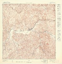
1947 Map of Jayuya NO
USGS Topo · Published 1947About this map
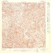
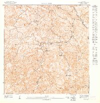
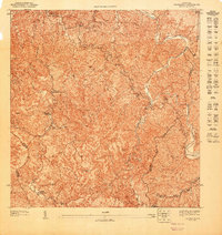
Central Santa Barbara serves as a prominent industrial landmark on this 1943 topography, reflecting the agricultural and milling legacy of the Municipio de Jayuya. The interior highlands of Puerto Rico are defined here by a dense network of watercourses, including the Río Grande de Jayuya, the Río Jayuya, and the Río Saliente, which carve through the steep terrain below Cerro Morales. This preliminary survey highlights a landscape dotted with traditional estates, such as Hacienda La Marina, Hacienda Gribina, and Hacienda Los Planes, showing the distribution of rural settlements and agricultural production before mid-century modernization. The map's high 1:10,000 scale provides exceptional detail for tracing the original footprints of these haciendas and the early layout of the Jayuya townsite, offering a clear view of the mountain economy during the 1940s.
Find a feature on this map
10 named features on this map. Tap any name to fly to it.
Don’t see what you’re looking for? This feature index may not catch every label — zoom into the map to look around manually.
Map Details
Editions of this 1947 Jayuya NO Map
This is the sole edition of this map. No revisions or reprints were ever made.
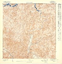
Other maps of this area

1946 · Utuado
USGS Topo · 1:30,000

1946 · Jayuya
USGS Topo · 1:30,000

1946 · Florida
USGS Topo · 1:30,000

1946 · Adjuntas
USGS Topo · 1:30,000
1947 · Utuado SE
USGS Topo · 1:10,000
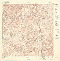
1947 · Jayuya NE
USGS Topo · 1:10,000
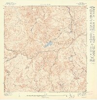
1947 · Jayuya SE
USGS Topo · 1:10,000
1947 · Florida SE
USGS Topo · 1:10,000
1947 · Florida SO
USGS Topo · 1:10,000
1947 · Adjuntas NE
USGS Topo · 1:10,000
Featured Places
- Jayuya, Jayuya
- Sector El Carajo, Jayuya
- Sector La Cuesta, Jayuya
- Villa Canonal, Jayuya
- Sector Estancias del Indio, Jayuya