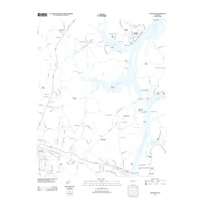
2013 Map of Jeannette
USGS Topo · Published 2013About this map
The town of Parsons anchors the southwestern portion of this West Tennessee landscape, where the street grid of the county seat transitions into the complex drainage systems of the Tennessee River valley. The eastern edge is dominated by the broad expanse of Kentucky Lake, a reservoir that reshaped the local geography. Along its shores, historical river activity is evidenced by several named landings such as Mousetail Landing, Lick Creek Landing, and Brodies Landing, which once served as vital commerce points for rural Decatur County. The terrain is defined by a series of narrow valleys and ridges, including The Narrows and prominent elevations like Lady Finger Bluff and Alley Bluff. Small settlements like Jeannette, Busseltown, and Hopewell are scattered throughout the interior, connected by a network of creeks like Short and Dirty Cr and Terrapin Cr. The map also details specialized areas like the Busselton Dewatering Area near the lake's edge.
Find a feature on this map
175 named features on this map. Tap any name to fly to it.
Don’t see what you’re looking for? This feature index may not catch every label — zoom into the map to look around manually.
Map Details
Editions of this 2013 Jeannette Map
This is the sole edition of this map. No revisions or reprints were ever made.
Other maps of this area

1936 · Pine View
USGS Topo · 1:24,000

1936 · Scotts Hill
USGS Topo · 1:24,000

1936 · Parsons
USGS Topo · 1:24,000

1936 · Daniels Landing
USGS Topo · 1:24,000

1936 · Jeannette
USGS Topo · 1:24,000

1936 · Sugar Tree
USGS Topo · 1:24,000

1936 · Cavvia
USGS Topo · 1:24,000

1936 · Perryville
USGS Topo · 1:24,000

1936 · Pope
USGS Topo · 1:24,000

1949 · Perryville
USGS Topo · 1:24,000